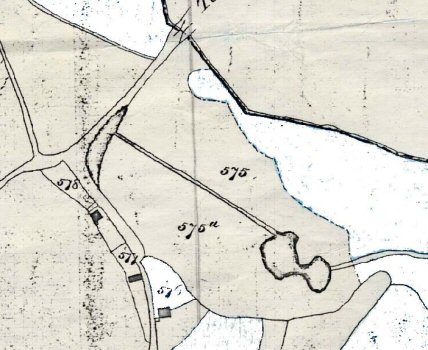
Caldicott Tithe Map of 1842 – area of Caerwent’s Brook. Supplied by John Nettleship. Shows the potential double hole at the western-most Whirly Pool. Also shows the strange channel leading across the Whirly Pool Mead field and a potential liver-shaped pond near the crossroads. This is now largely infilled.