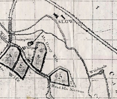
1775 Map (Caldicot Lordship Sale)*. Note that this is one of the few maps to mark both “Whirlpools”. The parish boundary (dotted) probably follows the c.700 CE course set by Brockwael*. The transfer and description of the boundary from the Book of Llan Dâv (c.895 CE*) don't mention the whirlpools (Note). However, note that by the eastern-most whirlpool there is a notable kink in the boundary running from the main stream up to the whirlpool. This traverses an area that is even now a lake most of the year, possibly suggesting, if we hold the boundary to be unchanged, that the area was flooded c.700.