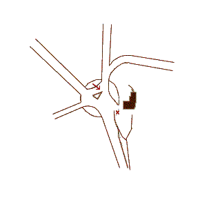
Sketch of the village crossroads from the 1880's 1:2500 map. Block is the pub; arrow shows approximate direction of photographs; x is approximate position of possible mound from rounded rectangle on map; north is up-screen, and the circle is approximately 45.5m east-west.